|

Sussex, New Brunswick
Home to the Gamblin Family of Canada
Sussex is at the heart of Kings
County, perhaps the prime example of a New Brunswick pastoral setting.
Please look at Sussex's
web site for more information.
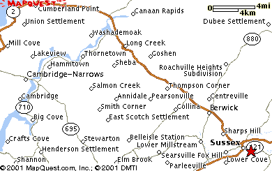 |
English Settlement was divided
into Pearsonville and Highfield which is located South of Route 2 about 8 km NW of Sussex
on Route 2. This is a current road map in 2021.
|
Wiveliscombe, England
Birthplace of William Gamblin in 1775
Wiveliscombe,
Somersetshire, England, is about 200 kilometers West of London at the intersection
of B3227 and B3188 toward the Cornwall coast.
The historic market town of
Wiveliscombe, locally known as "Wivey" is situated on the edge of the Brendon
Hills, it is a thriving rural community with many local services and a surprising range of
businesses. The town has a wealth of industrial archaeology relating to early iron
workings.
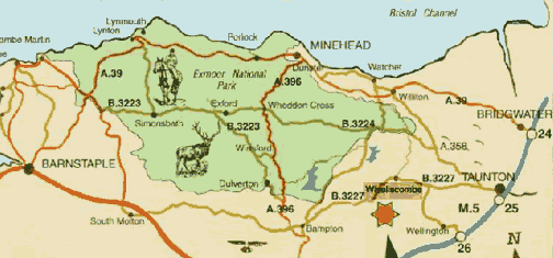 |
| Current Map in
2021 |
Wiveliscombe is the
gateway to Exmoor National Park and an ideal centre for walking and cycling. It is located
on the "West Deane Way" a long distance footpath only recently opened.
With two successful local breweries and extensive local services, the town is an important
centre for the western part of the Deane. Visit the town's web site at www.wiveliscombe.com
 |
 |
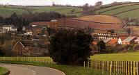
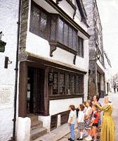
Wiveliscombe,
England, in 2000 |
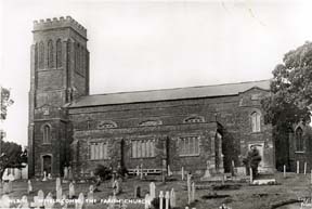
Parish Church in Wiveliscombe,
Somersetshire, England |
|
Plymouth, England
Beginning of William Gamblin's Royal Marine Career and Port of Embarkation to New
Brunswick, Canada, in 1819
Plymouth,
England, is about 300 kilometers South West of London on the Devon coast. In the
center of the current aerial view of Plymouth, you see the Royal Marine Barracks at
Stonehouse. The pictures of Stonehouse and nearby Devil's Point are from 1897.
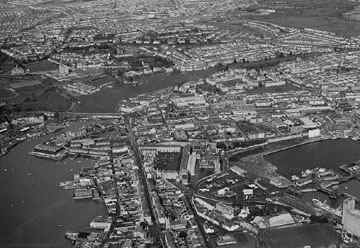 |
Aerial View of Plymouth,
England, in 2000
(Click on image to enlarge) |
 the site of the
Royal Naval Dockyard, a major employer in the city. It is also an important fishing port and handles passenger traffic to the Continent.
Manufactures include machine tools and chemicals. The city has an aquarium, a zoo, several
museums, and the University of Plymouth (1992, formerly a polytechnic college). Originally
named Sutton, the town received a charter and its present name in 1439. During the 16th
century it became a base for the expeditions of, among others, navigator Sir Francis
Drake. In 1588 the English fleet sailed from Plymouth Harbor to meet the Spanish
Armada, and in 1620 the Pilgrims embarked from Plymouth aboard the Mayflower.
During World War II (1939-1945) the city was bombarded by the Germans; it has since been
extensively rebuilt. City population (1996 estimate) 255,826. Visit the
town's web site at www.plymouthcity.co.uk the site of the
Royal Naval Dockyard, a major employer in the city. It is also an important fishing port and handles passenger traffic to the Continent.
Manufactures include machine tools and chemicals. The city has an aquarium, a zoo, several
museums, and the University of Plymouth (1992, formerly a polytechnic college). Originally
named Sutton, the town received a charter and its present name in 1439. During the 16th
century it became a base for the expeditions of, among others, navigator Sir Francis
Drake. In 1588 the English fleet sailed from Plymouth Harbor to meet the Spanish
Armada, and in 1620 the Pilgrims embarked from Plymouth aboard the Mayflower.
During World War II (1939-1945) the city was bombarded by the Germans; it has since been
extensively rebuilt. City population (1996 estimate) 255,826. Visit the
town's web site at www.plymouthcity.co.uk
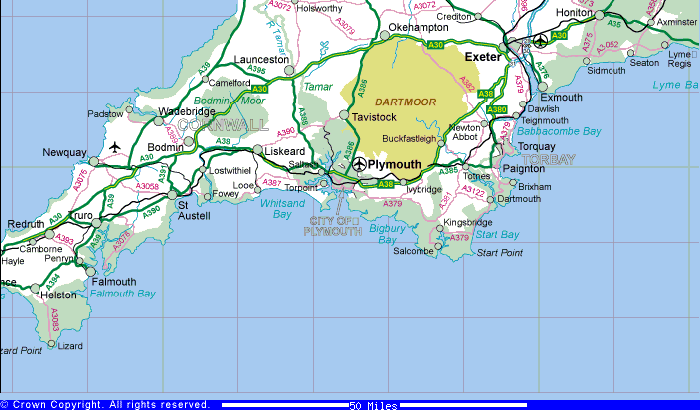 |
| Current Map in
2021 |
 |
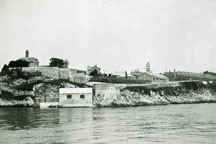 |
| Stonehouse Royal Marine Barracks
in 1897 |
Devil's Point in 1897 |
|
|
Copyright © by The Gamblin Family of New Brunswick
Contact our webmaster
This page last updated on Thursday, January 28, 2021
|
|